Winter Storms are significant Natural Hazards in the Upper Midwest.


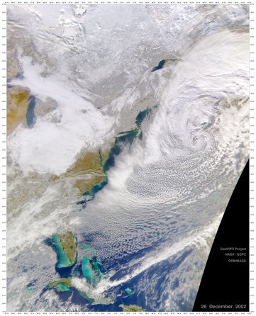
This is the Boxing Day view of eastern North America, compliments of the Sea-viewing Wide Field-of-view Sensor (SeaWiFS). Snow cover (whitish pixels) is visible across many areas where cloud cover does not obscure the surface, including most of New England and parts of southeastern Canada.
A severe winter storm rolled eastward across the central United States between December 23 and 25, 2002, bringing a white Christmas to millions of people in a wide swath stretching from the southern Great Plains region all the way to New England. Many areas in the northeast reported blizzard conditions during the storm, in which snow accumulated on the ground at a rate of up to 5 inches (12 cm) per hour. As much as 3 feet (1 meter) of snow fell in some places over the 48-hour span. Unfortunately, the storm resulted in at least 19 deaths. There have been a number of car accidents reported in many states and tens of thousands of people living in the northeast were left without power.
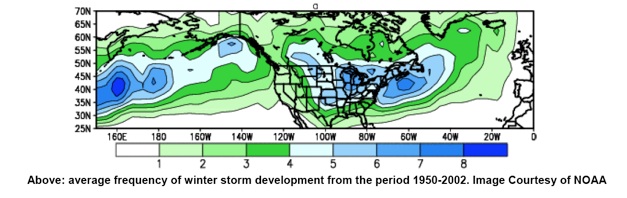
The upper midwest is an area of high frequency for winter storm tracks. This frequency varies greatly from year to year, so it can be misleading in any given year. Forecasters are now aware that changes in sea surface temperatures for areas of the Pacific or Atlantic Oceans can affect the upper midwest, so it is valuable to be aware of phenomena like El Nino or the North Atlantic Oscillation.
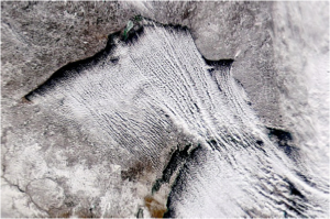
In the Keweenaw we have a microclimatic condition called lake effect snow storms which is remarkably dominant at some times and can cause heavy snow conditions in one place while weather is very different in places only a few kilometers away. This lake effect snow requires careful attention to details to enable accurate forecasting.