

Feb 5, 2007
MODIS
http://earthobservatory.nasa.gov
The MODIS image above shows lake effect snow clouds, a feature of winter in Great Lake locations, especially the Keweenaw Peninsula. It happens when cold, dry polar winds blow over a lake that is substantially warmer. This causes evaporation of the lake and builds low clouds that form bands than can be traced hundreds of miles. When they are lifted by flowing over hills, they produce snowfall. In the Keweenaw we have this type of winter precipitation very often.
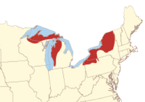
Lake Effect Snow regions of Great Lakes
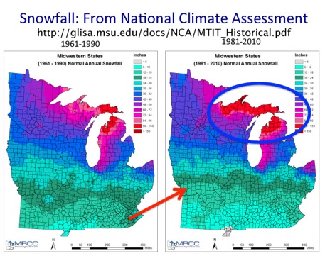
Snow in a warming world: Mean seasonal snowfall (inches) across the Midwest for a) 1961-1990 (left) and b) 1981-2010 (right) periods. Figures courtesy of Midwest Regional Climate Center. We look at the last 30 years compared to the previous 30 years, we see this signal emerging. Decreases in snow and snow amount are marching up from the south (red arrow), and lake effect snow is increasing around the Great Lakes (blue circle).
5 December 2000
MODIS
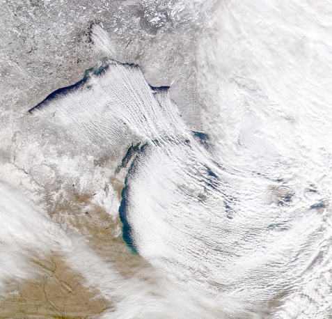
A Great Lakes Lake effect snowstorm typically happens with whiteouts on one side of the lake (downwind) while conditions are clear and 20 degrees colder on the lee side. The timing is typically for the lake effect to take place after the passage of a cyclonic snow storm which may produce more regional snowfall.
The heaviest and most persistent snow is typically nearest to the lake, but where topography is rising.
http://www.noaa.gov

11 Dec 2009

Lake effect clouds form streaks or bands elongated by the winds. Clouds form in the upwelling regions where evaporating water vapor freezes or condenses to form cloud particles. The bands then travel over the lake and when they reach land are typically lofted over topographic barriers (hills) where they cool and precipitate.
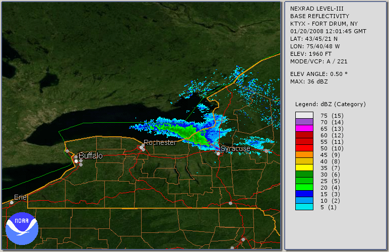
Weather radar systems track clouds such as lake effect bands, although the low altitude of such features makes this sometimes marginal. Here a lake effect band develops along Lake Ontario north of Rochester and Syracuse.