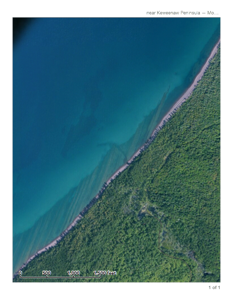
South of 7 Mile Pt, the contact between the Lake Shore Traps and the Nonesuch Shale can be traced through the shallow clear Lake Superior water.
Lake
Shore
Traps
None-such
Shale
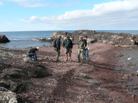
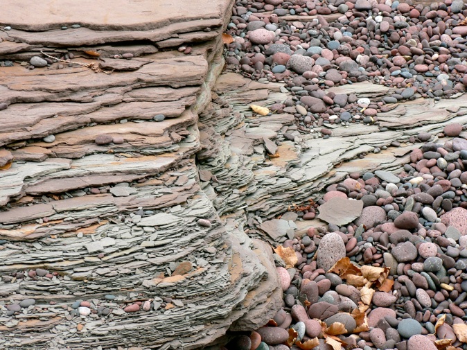
7 Mile Point is an entry to a great shoreline walk which crosses the Lake Shore Traps, allowing observations of lava flow features. There are beaches with high and low energy aspects on either side of the point. The Nonesuch Shale outcrops south of the Lake Shore Traps. There is wonderful shoreline topography and two rivers flow into the lake. And dunes!
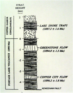
The Lake Shore Traps are the youngest of the lavas in the Keweenaw, at 1087 my.


excerpt from: GEOLOGIC MAP OF THE KEWEENAW PENINSULA AND ADJACENT AREA, MICHIGAN By William F. Cannon and Suzanne W. Nicholson
At the top of the Copper Harbor Conglomerate there is an abrupt change to lacustrine deposits of the Nonesuch Formation. The Nonesuch is composed of massive to laminated siltstone and shale and fine-grained sandstone with a preponderance of reduced-facies units. The absence of interbedded fluvial and lacustrine facies at the base of the Nonesuch, combined with the presence of fine-grained reduced lakebeds immediately overlying the oxidized fluvial sands of the Copper Harbor Conglomerate, suggest the rapid establishment of a lake of regional proportions. Studies of the Nonesuch Formation in the White Pine Copper Mine about 30 km west of the map area indicate the presence of minor growth faults, at least near the base of the formation, so it appears that some regional extension may have persisted during this phase of the sedimentary history (Mauk and others, 1992).