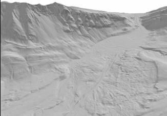
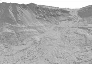
Turtle Mountain LiDAR
DEM(images showing bare earth and
full feature DEM)
A powerful advantage of
airborne LiDAR data is the ability to remove vegetation and view the bare
ground surface.This is achieved by
distinguishing between returns that hit trees/buildings (first returns) and
the ground.The data density if so
great that if first returns can be identified they can be removed and the
ground points can be used the interpolate the ground surface, allowing
generation of a digital terrain model.The above images show the example from turtle Mountain with the image
of the left with trees removed.