


LiDAR (Light Detection and
Ranging)
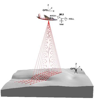
| Another technique utilized
is airborne Light Detection and Ranging (LiDAR). This technique uses either a plane or
helicopter with positioning very accurately tracked using GPS. A laser system is positioned on the base of
the aircraft and light pulses are emitted and returned on a very high
density. By knowing very accurately
the position of the aircaft and the distance between to the ground for each
light return, a very high resolution elevation dataset can be collected. Positional accuracy of the data is
typically quoted as 0.3 m vertical and 0.5 m horizontal (based on a
collection density of ~ 1 point per metre) but can be improved with higher
density collection. |