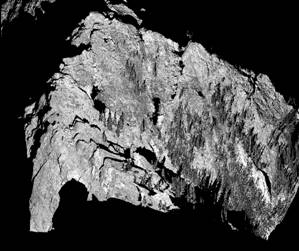
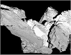
The images above represent
scans obtained from the North Peak of the mountain towards the rubbly,
unstable area at the head of the 1903 Frank Slide.With a data density of >>> you can
clearly see the large blocks and trees in this zone.While very high resolution data can be
collected, there are issues with instrument range and limitations regarding
access to suitable set up areas that limit the ability of this technique to
scan large areas but it is very promising for smaller zones.This is discussed in more detail in the
paper by Sturzenegger et al (2007)