Preliminary Results– Turtle Mountain deformation and coal mine subsidence
1
2
3
4
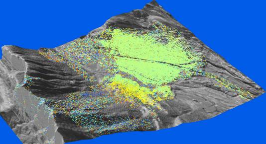
For Turtle Mountain we have
incorporated data from 2000 to October 2006 to generate a deformation map
utlizing the Permanent Scatter INSAR technique (PS-INSAR). This technique
takes scenes of data from different time periods, identified permanent
scatters/coherent targets) and tracks changes over time. This allows to
better distinguish potential errors in the data (such as athmospheric
effects) and allows to track movements with the resolution of a few
millimeters per year.In this image
the green area has been set as the stable area and the other movements are in
relation to this stable area.There
were three main areas (1 to 3) that we identified.Areas 2 and 3 appear to represent shallow
movement of talus on a side slope.Area 1 is overlying abandoned underground coal mine workings
(discussed on next slide).