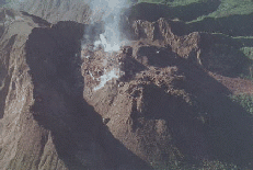
Soufriere Hills, Montserrat, West Indies
- Go here for the latest scientific information on the eruption!
- Weekly Scientific Reports of the activity from Montserrat Volcano Observatory
- Morning and Daily Reports From Montserrat Volcano Observatory
- Scientific Updates and Press Releases from the Government Information Unit
 Other Eruption Updates
 Images
 Maps
Maps
- Map of the Caribbean Islands showing political boundaries
- Road and Relief Map of Montserrat Island, Soufriere Hills
- Simple Map showing peaks, Plymouth, and dimensions © Lyn Topinka, USGS/CVO
- Volcanic Hazards Map showing "Sequential hazard zone of Soufriere Hills Volcano. Zone 1 is the earliest hazard zone affected by mudflows derived from the major fumaroles. Zones 2-7 represent those areas that would be covered by deposits from an eruption centred on Castle Peak dome that increased sequentially in strength by five increments."
- Caption: Figure 9, p.549 from Wadge, G., & Isaacs, M. C. (1988). Mapping the volcanic hazards from Soufriere Hills Volcano, Montserrat, West Indies using an image processor. Journal of the Geological Society, London, 145, 1988, pp. 541-551.
 Related Sites of Interest


 Government of Montserrat and Montserrat Volcano Observatory
 Other Eruption Updates
 Montserrat Red Cross Appeal For Assistance
 Smithsonian Institution Global Volcanism Network Bulletins
 Images
 Maps
Maps VolcanoWorld's Soufriere Hills Information
 Related Sites of Interest